Drying out and heating up to end the week in Houston!
Tracking the tropics next week in the Gulf The weather is expected to remain warm and humid in Houston, with temperatures expected to reach the lower-90s but feel like the triple digits due to high humidity. The National Hurricane Center has issued a warning of scattered showers and thunderstorms, mainly west of I-45, which can bring heavy downpours and frequent lightning strikes. The forecast continues to be dry and hot, with rain chances expected to increase on Friday and Saturday. Two tropical disturbances with a low chance of development are being watched by the National Hurricane Centre, one of which could become our first named storm. A second wave of storms could arrive in the western Gulf of Mexico early next week, potentially leading to heavy rain in southeast Texas, potentially reaching up to 6″.

Publicerad : ett år sedan förbi Anthony Yanez, Caroline Brown i Weather
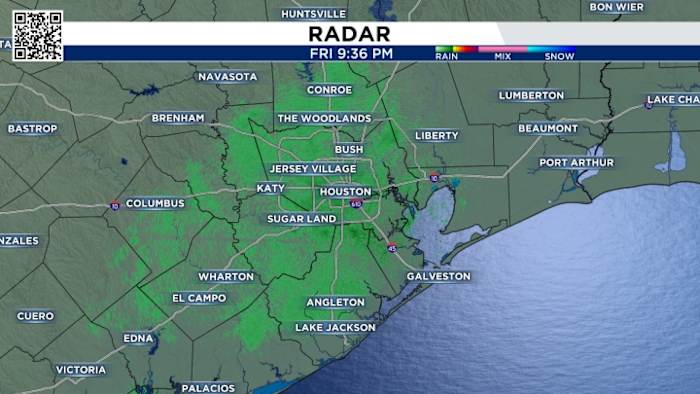
It’s another warm and humid afternoon! Temperatures are in the lower-90s but it feels like the triple digits with the high humidity. We have been tracking scattered showers and thunderstorms, mainly west of I-45. These storms can bring heavy downpours and frequent lightning strikes. Remember, when thunder roars, head indoors!
Tonight will be pleasant! We will have partly cloudy skies with overnight lows in the mid-70s.
Thursday we begin our transition to hot and dry conditions. We will have sunny skies with highs in the mid-90s. There is a possibility for one or two thunderstorms by the coast, but most will remain dry.
Our forecast keeps us dry and hot Friday and Saturday. Rain chances ramp back up Sunday after 1PM.
We are watching two tropical disturbances that each have a low chance for development. The National Hurricane Center has outlined the storms in the Eastern Gulf with a 20% chance of becoming our first named storm as it moves northeast away from the United States into the western Atlantic basin.
The same area of tropical moisture in the southwestern Gulf will send out a second wave of storms into the western Gulf of Mexico. early next week. We could get rain in southeast Texas as early as Sunday night. The issue is these storms is their lack of organization. If the trend of a large area of disorganized low pressure remains, southeast Texas could get heavy rain lasting through Wednesday. Rain totals in this scenario could get up to 6″. This is a good reminder you don’t need a named storm for it to flood. This outcome is far from determined.
Lots of happenings on this 10-day forecast. Flag day is incredibly hot. Most of Father’s day looks dry but our first wave of rain may arrive at night. Juneteenth may be stormy along with the first day of summer Thursday.
