Heavy rain possible next week due to a tropical disturbance in the Gulf of Mexico
In brief: After one more day with storm-o-clock weather this afternoon, Houston will see a sunnier and hotter pattern set in through the first half of the weekend. We’re not going to get supe… The weather is expected to remain sunny and hot for the first half of the weekend, with temperatures reaching the low 90s and low 70s for much of Houston. However, there is a potential for scattered to widespread showers and thunderstorms throughout the week, with some locations seeing accumulations of 1 to 2 inches of rain, while most of the area sees considerably less. The potential for tropical rainfall is also possible due to a tropical disturbance in the Gulf of Mexico, which could bring moderate to heavy tropical rainfall to the Texas coast, including the greater Houston area. The best forecast models are split on the evolution of this system's evolution and its location.
Pubblicato : 2 anni fa di Eric Berger, Zack m in Weather
In brief: After one more day with storm-o-clock weather this afternoon, Houston will see a sunnier and hotter pattern set in through the first half of the weekend. We’re not going to get super-hot, but it will feel like June out there. By Sunday our attention turns to the Gulf of Mexico, and the potential for tropical rainfall much of next week.
We’re going to see one more day with the potential for scattered to widespread showers and thunderstorms. Conditions will be similar to what we’ve seen on Monday and Tuesday, with storms firing up during the late morning, afternoon, and early evening hours due to a combination of plenty of moisture in the atmosphere, the sea breeze, and an overall perturbed atmosphere. Similar to the last couple of days, a few locations may see accumulations of 1 to 2 inches of rain, whereas most of the area sees considerably less.
Skies will be partly to mostly sunny when it’s not raining, with high temperatures reaching the low 90s for much of Houston. Outside of thunderstorms, winds will be light, around 5 mph from the northwest. Lows tonight will drop into the mid-70s.
This will be a bit of a transition day as high pressure builds into our area from the northeast. I can’t rule out some isolated showers and thunderstorms, but most of us will see sunny skies with high temperatures in the low- to mid-90s. Lows will drop into the mid-70s.
These will be sunny and hot days, with highs in the low-to-mid 90s. However, dewpoints will be a bit lower than a classic Houston summer, especially on Friday. This will take some of the sting out of the daytime highs, and make evenings a little more comfortable. Lows on Friday night could drop into the low 70s for much of Houston. Rain chances for both of these days are less than 10 percent.
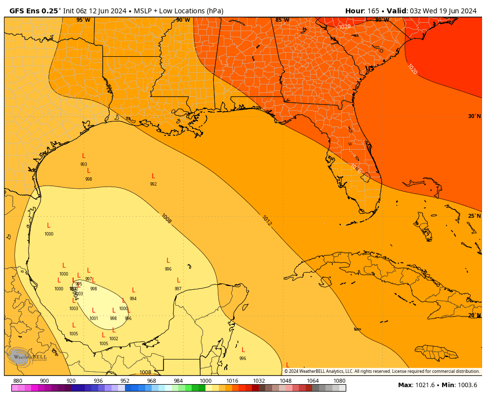
Starting on Sunday, our attention will need turn to the Southern Gulf of Mexico, where we could see some sort of tropical disturbance develop. Right now I don’t anticipate anything too organized—i.e. with strong, hurricane-force winds. However, whatever does develop is likely to be an efficient conveyor belt to bring Gulf moisture onshore, and therefore serve as a source of moderate to heavy tropical rainfall.
Our best forecast models are split on the evolution of this system, and how far north it moves (this will depend on the strength of high pressure over the southern United States). What I can say is that, beginning Sunday and especially from Monday through Thursday, there will be the potential for heavy rainfall along the Texas coast, including the greater Houston area.
It is a folly to try and predict rainfall totals because there are still so many uncertainties about a forecast for 5 to 10 days from now. But this is the kind of thing where our area could see 1 inch of rainfall, or 10 next week. In any case, most of next week should see a cloudier pattern, and this should help to limit highs in the upper 80s. Matt and I will be keeping a close eye on this, and when we know something, you will.